Updated in June 2025
The french aeronautical CHARTS
4 kinds of VFR charts are available for France.
- 1/500,000 aeronautical
charts showing in details what will be under your wings. Several
choices, even digital charts).
- 1/1,000,000
aeronautical charts giving among other things all the informations
concerning the P,Z,R zones you will cross, the way to know whether
they're active or not, and for some of them, whether you may
enter them when active. (See
details here.) This information is also available on the SIA web site, in the AIP.
- 1/250,000 charts for some areas where the airspace is especially complex.
- Airports plates.
You can find special charts for gliders and helicopters and
microlights, described below in the relevant sections.
In any case, you have to check
the relevant Notams and SUP AIP for your route.
Beware : the charts showed here are not up to date. Don't
use them for flight planning.
One more remark before you read this section : what you
will find here is information, not advertising. No one had
to pay nor give anything to be listed here. Several publishers
provided me with extracts, other refused or didn't answer my
requests. The opinions expressed here are mine. They're based
on my own experience and use of French charts.
1/500,000 charts
One set of charts covers France. It does not depict microlights
airfields or strips.
IGN/OACI
In my opinion, these charts are the best choice as long
as 1/500,000 are concerned. The information and captions are available in French and English.
They are published by the National Geographical Institute
(IGN) for the background, and the SIA (Aeronautical information
service) for the aero information. Both are state agencies, and
they produce official informations.
Each release includes of course a complete update of the
aeronautical data. The topographical background of the 2025 charts was updated in
2024. The electrical power lines data were updated in december 2024.
These charts were improved along the years:
- Since 2013, they depict all airspace up to FL115. Until
2012, the charts were limited to 5000ft AMSL and you had to have
an other chart if you flew higher. What about the airspace above
FL115? Well in France it's quite simple : it's class D almost
everywhere up to FL195 (but over the Alps), then class A. If
you fly VFR, you're very unlikely to get a clearance to enter
this airspace, although theorically, it should be possible.
Left is an extract of
the old OACI chart released in 2011, with the airspace up to
5000AMSL only, and right is the 2025 release. Note that now the
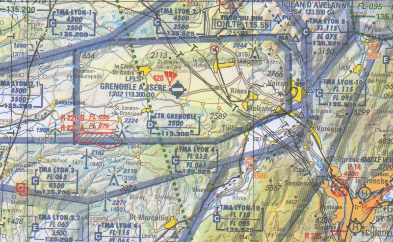
upper parts of the Lyon TMA appear on the chart , surrounding
the lower parts. (You can click on it to enlarge it.)

©IGN - 2011
|
©IGN - 2025
|
- Some military restricted zones (we have plenty of them) meant
for very high speed, low altitude flights are defined by AGL
limits. Now, the charts also bear a mention of the zone maximum
altitude (ASL), which makes flight planning easier. You don't
necessarily have to find the terrain elevation and add it to
the zone height limit to know how high you must fly to avoid
it.
- Since 2019, the length of the longest runway is given for each airfield. Compare the data for St Yan airport below. Left, the 2017 release. Right, the 2025 one. Note that beside the altitude and tower radio frequency , the length of the runway is available : 20(00)m.
Also, the symbols enable to know whether an airport is civilian, or mainly used for military operations, but still open to civilian activity, or restricted to military activity.
©IGN - 2017 | 
©IGN - 2025 |
- In 2020, new informations appeared about some specific helicopter IFR activity. Also, frequencies are now given with 3 decimal digits to take into account the new 8.33kHz interval between frequencies.
- More details are given for model aircraft activities, especially their maximum heights which is color coded and can extend up to over 2000ft AGL
The advantage of these charts is their very detailled background.
No airways though.
You will find them only on million charts.
France is covered by 4 charts, NW, NE, SW and SE. The 944 SE chart includes a 1/1,000,000 map showing
the mandatory routes to Corsica. They exist in thick paper (around 24 euros) or
laminated format (around 29 euros). They are also available digitally (see below).
They're updated once a year, by late March
or early April. Make sure that you order the last ones.
The 1/500,000 Alps special chart for gliders can be downloaded from the SIA website.
You can order the half million charts directly from the IGN online shop (in French) or from Amazon - France
The IGN DIGITAL ICAO CHART
The former CD-Rom including the 4 french ICAO digital charts
as a whole doesn't exist any longer.
As a substitute, you can download from the IGN website and for a fee a digital carbon copy of each of the IGN paper charts.
You will need a software or an ECW compatible device to use them
then.
The IGN provides a free and basic software enabling
you to use the digital charts, if you don't already have one.
The digital half million chart can also be read for free from
the IGN
maps webpage.
You can access directly
the digital chart with this link or by searching "aeronautique"
- aeronautical in French - within the IGN website.
If you are a drone pilot, here is a map of drones exclusion zones.
RODGERS DATA
This austrian editor publishes ICAO charts. They have 4 charts for France. Although I contacted them in 2019 and they promised to send me a sample of the chart I never had a chance to review them and have an opinion.
Their charts can also be downloaded digitally.
Although it's a private publisher who only uses official data and does not make it, they have an asset, compared with French publishers, for pilots flying across several countries in Europe. You can have all the countries you will travel in depicted the same way with a uniform set of charts. The same symbols no matter the country.
JEPPESEN
No more paper charts from Jeppesen. They have digital products. I could not test them so
I can't give an opinion about them.
1/1,000,000 charts
The two previous competitors are here again in this category.
But they're not alone. All charts but the SIA one are updated
once a year.
This time, the aim of the chart is not to be able to match
in flight what is under you with what is on your knees, but to
have as comprehensive an aeronautical information as possible.
You need to know everything about CTR, TMA and P,Z,R zones and
their activity in the whole airspace you might fly in (SFC to
FL195), VORs, and possibly APT, etc...
SIA - Documents VFR (VFR folder)
These charts can be downloaded for free from the SIA website. There are 2 charts for France : North and South.
Again , this is the "official" chart with the "official"
aeronautical information.
For several years, SIA has been improving its chart. The book
is as complete as before, with all you need to know about the
zones (when they may be active, whom to contact to know whether
they're active or not, what happens in the zone (ground to air
shooting, low height very high speed training, etc...) what the
activation involves : no entering or just PPR clearance... The
most comprehensive information you'll find about LF-R LF-D LF-P
zones. The LF-R,P,D zones part is written in French but this
should not be a problem, because the information is
simple. This book can also be downloaded from the SIA website
The chart itself is divided in two sheets with a colour background
and much more information than just zones, TMA, CTR, VOR. Airways
are depicted on the chart. You can order this million with or without
a VFR guide, containing many regulations, and general information
about VFR Flying in France. I advise you to buy the guide. It
will be useful and for just 2 or 3 more euros, it might avoid
you the trouble of getting the French air regulation. In the
bundle is included a chart with no background depicting only
the "high speed - low altitude" military zones (also
depicted in the charts with background), to improve the pilots
awareness of these dangerous zones.
In my opinion, if you want a really comprehensive information
about the French lower airspace (under FL195), this is a very good choice. Unfortunately, this info is in French only.
This chart is updated TWICE a year. (Spring and autumn). So
make sure you get the last edition.
The SIA webpage is available in English.
VFR France jour
This is a very well designed chart., but now the official data is available for free from the SIA website, so why bother?
No book here. Therefore, you will not know why a zone
is dangerous or restricted. But you will know, as for the SIA
charts, when they can be active and whom to contact to know whether
they're actually active, when such an opportunity exists. Lots
of informations (APT...), in the background and in the aeronautical
frontground, and really easy to read and to use. It is printed
on both sides of the chart, each side depicting half of France.
(North and South)
Good :
- The charts are printed on a "untearable", laminated
paper.
- The chart includes for some airfields at least information
about gas availability (100LL, Jet A1,car unleaded)
Bad:
- Frequencies are now written without the first digit (the
1). For exemple, 120.9 is written 20.9 . You have to mentally
add 100 which is not very convenient depending on the workload,
and more importantly, it was a distinctive sign that a number
on the chart was a frequency, since they all begin with 1, and
have a decimal part. Now you have to look for them with more
attention, among other numbers (elevation...).
- If you like to fly airways, forget it. They are not depicted
on this chart. Choose the SIA one instead.
Don't use it either if you fly night VFR. It is limited to day
VFR. Some informations such as night compulsory itineraries are
not depicted.
A special release for microlights
has been published since 2003. Compared with the plane chart
:
Added:
- + a list of microlights platforms with the actual name of
the platform and a phone number to contact the operator.
- + the airport call sign is underlined if the airport is non-controled,
but has an IFR procedure.
Removed:
- - no radioaid (VOR, Locator and DME)
- - no indication of right hand patterns
- - no indication of the prefered QFU (runway)
I don't think that the microlight version has any interest,
even for microlights pilots. Better, in my opinion, to buy the
regular, plane one. It depicts microlights strips anyway, with
more information.
The chart (since 2011) exists as a laminated wallpaper sheet,
printed on one side only and showing France on a whole. You can
therefore pin it to your wall. It is not meant to be folded and
used in flight, the chart is too thick.
IGN Vol Libre en France
This is not an aeronautical chart. It is basically the 1/1,000,000
road map of France published by the IGN where are added places
where paraglider are flown. At the back of the chart is a comprehensive
list of all these places with precise lat long coordinates, the
kind of activity in each of them (paragliding, hang gliding...)
You will also find phone numbers for each platform to get in
touch with someone. When available, you will also find the email
adress and web page URL of the person or association in charge
of each platform. If you consider doing this kind of activity
while touring France, this map will certainly be useful. It is
also much cheaper than aeronautical charts. To see an extract of this chart, click on this link.
This chart is published with the FFVL, sport federation for hang
and para gliding.

More than 600 airfields already updated in France,
the UK, Belgium, Luxemburg , Switzerland, South Africa
600 UK airfields
1/250,000 charts
The french airspace is more and more complex, with many interlaced zones in some areas. There, it may be useful to have more detailled maps. They can be downloaded from the SIA website for free. You can also buy them on paper directly from the SIA.They are basically an enlargement of the million SIA chart with the same information, but easier to read. Such a chart is available for :
- the area around Paris
- the area around Lyon
- the area around Marseille
- the area around Nice
- the area around Toulouse
- the area around Metz and Strasbourg
RTBA
A large part of the french airspace can be used by military aircraft flying low and fast. To enable them to use it without risking to face an other aircraft, a lot of restricted areas can be activated, meaning closed to all traffic but them. A chart depicts these airspaces. You can download it for free from the SIA website.
Airports plates
SIA - Atlas VAC
Two folders of plates for this french publication. Again "The"
official data. Very good quality, easy to use, but quite expensive.
(Around 110 euros without update, 150 with update subscription.)
The SIA has also made the whole AIP including the airports
charts available and downloadable for free on their web page since January 2004.
Features are very similar to the Bottlang ones, with a local
map and a detailled APT map for each APT, and an approach map
for larger ones. Very detailled information on restrictions,
particular conditions... OACI classified APT only. In English
and in French.
They also publish a special release of theVAC Atlas for Helicopters.
Airfields where helicopters are allowed only are covered, including
specific places such as helisurfaces and helistops near hospitals
or plants.... Special routes and circuits (compaired with planes
or gliders for exemple) are enlightened.
To order or to get informations, see the SIA web page in English
Jeppesen Bottlang
Nothing to complain about as far as quality is concerned.
Again, pilots already used to Jeppesen products will find it
easier to use. Same thing if you travel in several countries.
Jeppesen will enable you to use only one kind of airport charts
in all these countries. Prices are similar to the VAC Atlas.
Moreover, You can buy a trip kit, (with no updating
of data), saving a little money, or, if you cross borders, bundles
of several national bottlangs.
OACI classified
APT only.
I asked them 2 times to send me a plate of the Bottlang for
you to see, but got no answer yet. Maybe they didn't like my
comments about their mistakes, or they just don't care?
To
order or to get informations, see the Jepp web page
If you got here through a search
engine and if this page is not displayed in a frame, click here to see the whole site.